
Private Property
Property boundaries are constantly changing, and it would be impossible for us to continually check every single trail we have listed on our web site. Hike respectfully, and responsibly; check land ownership prior to departing! Permission from the land owner is almost always required unless the trail is on crown or public land, or signage stating otherwise is posted. There is no "right to roam" in Canada. Just because a trail exists, does not mean it is necessarily open for public use!
Use iMapBC and HIKE SMART!
-
Visit iMapBC's web site: https://maps.gov.bc.ca/ess/hm/imap4m/
-
Click Data Sources
-
Click Upload Data and import your GPX route
-
Click "Add Provincial Layers" and choose Land Ownership and Status => ParcelMap BC Parcel Fabric Cadastre - By Owner Type => PMBC Parcel Cadastre By Owner
-
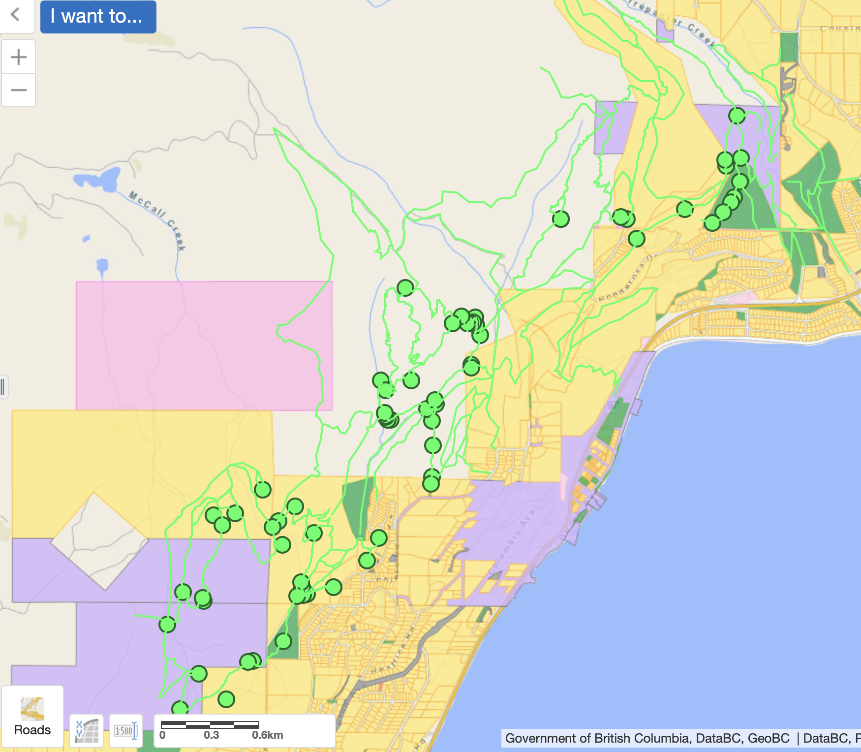
Zoom into your uploaded GPX route, and the map will now be color coded. Click a colored zone for more information. Currently, yellow zones are private property and should not be accessed without permission from the land owner.
Here's an example of the Peachland Trails GPX trails from our web site uploaded behind the land ownership map. Notice how many of the trails exist on yellow parcels that are private property! If you'd like to contact the owner, title searches can be done relatively cheaply via Land Titles BC online using the PID number from iMapBC.