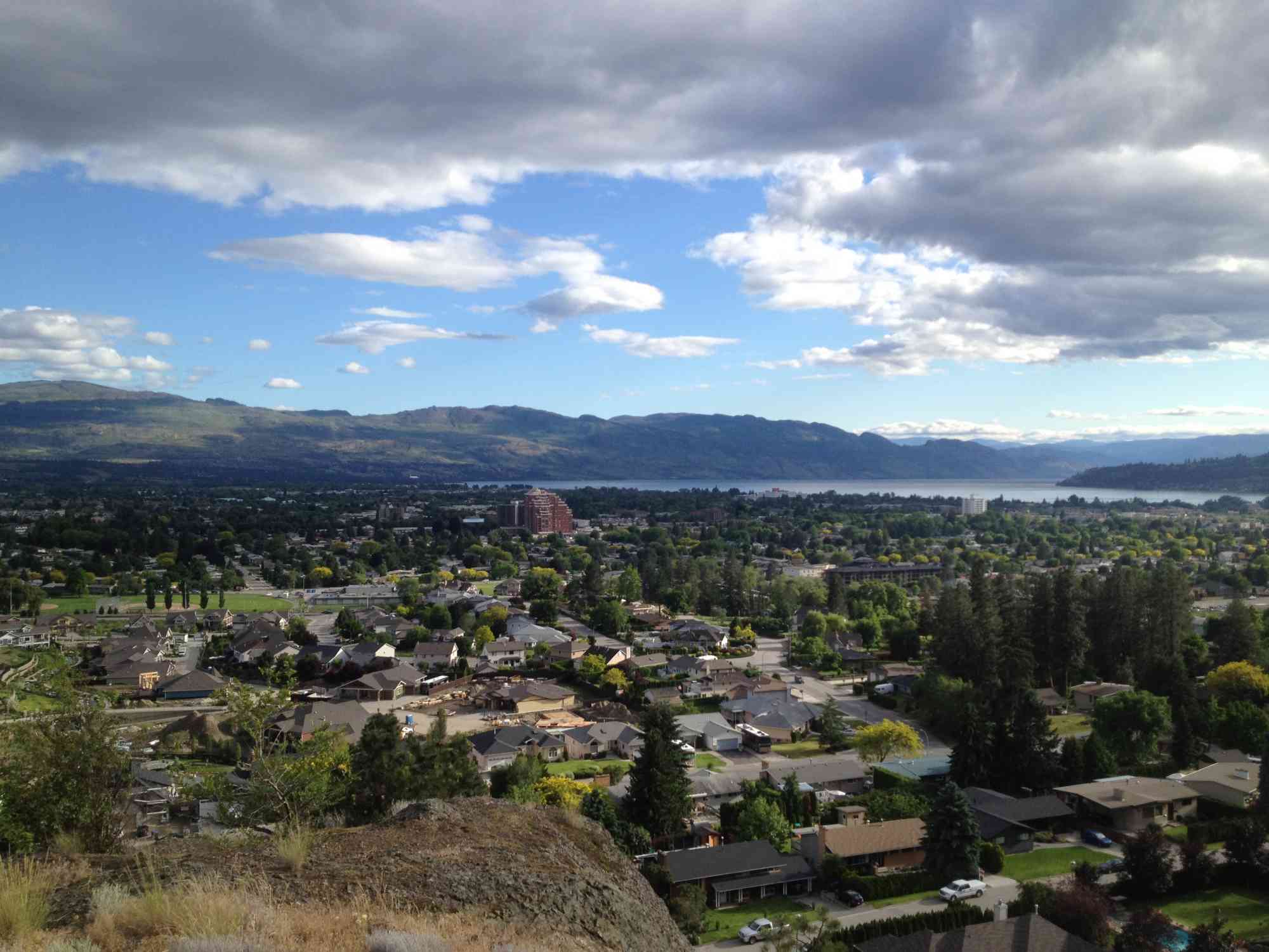
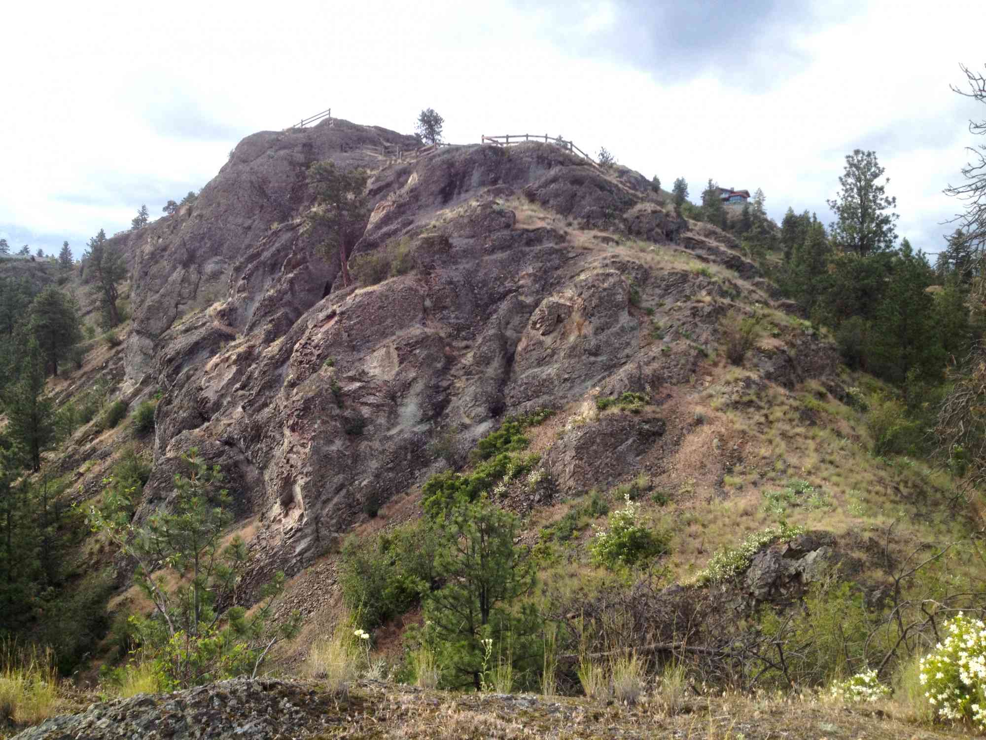
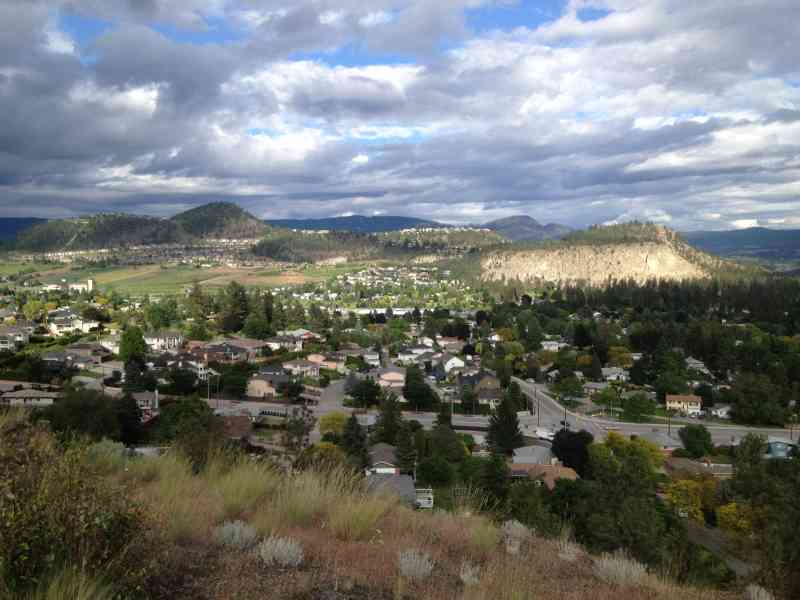
Highpoint Hill

Glenmore

7 min from Downtown Kelowna
49.900215, -119.465826
A short network of trails in Glennmore that offer great views of downtown and Knox.
Route
  • Short
  • Easy
  • Out & Back Same Way
  • 2.00 km round-trip
  • 30 min solo
  • 59 min group
  • 167 m gain
Kids & Pets
  • On-Leash
  • Child-Friendly
Features
  • GPS Map available.

Address

49.900215, -119.465826

Driving Time

From Downtown Kelowna, approximate travel time by car is 7 min.

Notable GPS Co-ordinates

Detailed Directions

1) From downtown Kelowna, on Highway 97 head East towards Vernon.
2) Turn left on Gordon
3) Turn RIGHT on Clement
4) Turn LEFT on Clifton
5) Park at the dirt patch on the left just beyond High Rd as you head up the hill.

Google Directions

Linear Trail
This is a linear (out and back/not a loop) trail; the values below indicate the one-way statistics from the trailhead to the end of the route.
  • Starting Elevation: 397 meters
  • Ending Elevation: 480 meters
  • Maximum Elevation: 480 meters
  • Elevation Gain: 167 meters
  • Elevation Loss: -90 meters
  • Slope Up: 23.00%

Duration Calculator

The metrics for this trail have been converted to round-trip formation for distance and elevation gain/descent if necessary.

Estimated Time: -- hours

View Full Screen

Map Waypoints

GPS Notes
We have often color-coded our GPX tracks. While it is not always the case, we have tried to use the following convention on our newer maps:

Green/Blue: human-verified by our volunteers.
Purple: overgrown trail, bushwhack, or on private property.
Red: default color or not reality-checked
Yellow: Road
Other Colors: May have been satellite traced or imported from third party sources.

While we strongly believe our GPS are accurate, please be aware that no logging system is perfect and to be aware of potential errors. Use at your own risk.
There are currently no user comments.

Leave a comment

You must Login to post a comment!