
Okanagan Mountain Park: Exterior Perimeter
Okanagan Mountain Park: Exterior Perimeter
Kettle Valley
30 min from Downtown Kelowna
5937-5941 Lakeshore Rd, Kelowna, BC V0H, CanadaThe most intense workout of your life; make memories that will last just as long during the ULTIMATE Okanagan, nay, Canadian hike! Experience the feeling of being a settler of the 1800s, blazing a trail across Canada. Face the raw elements and feel the sheer exhaustion and satisfaction as you trek across seemingly endless mountainous terrain.
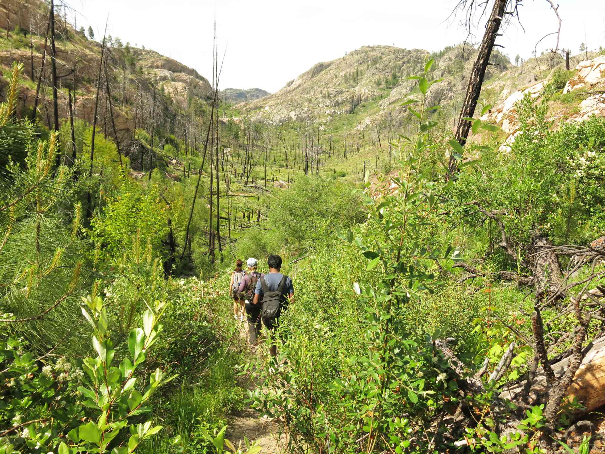
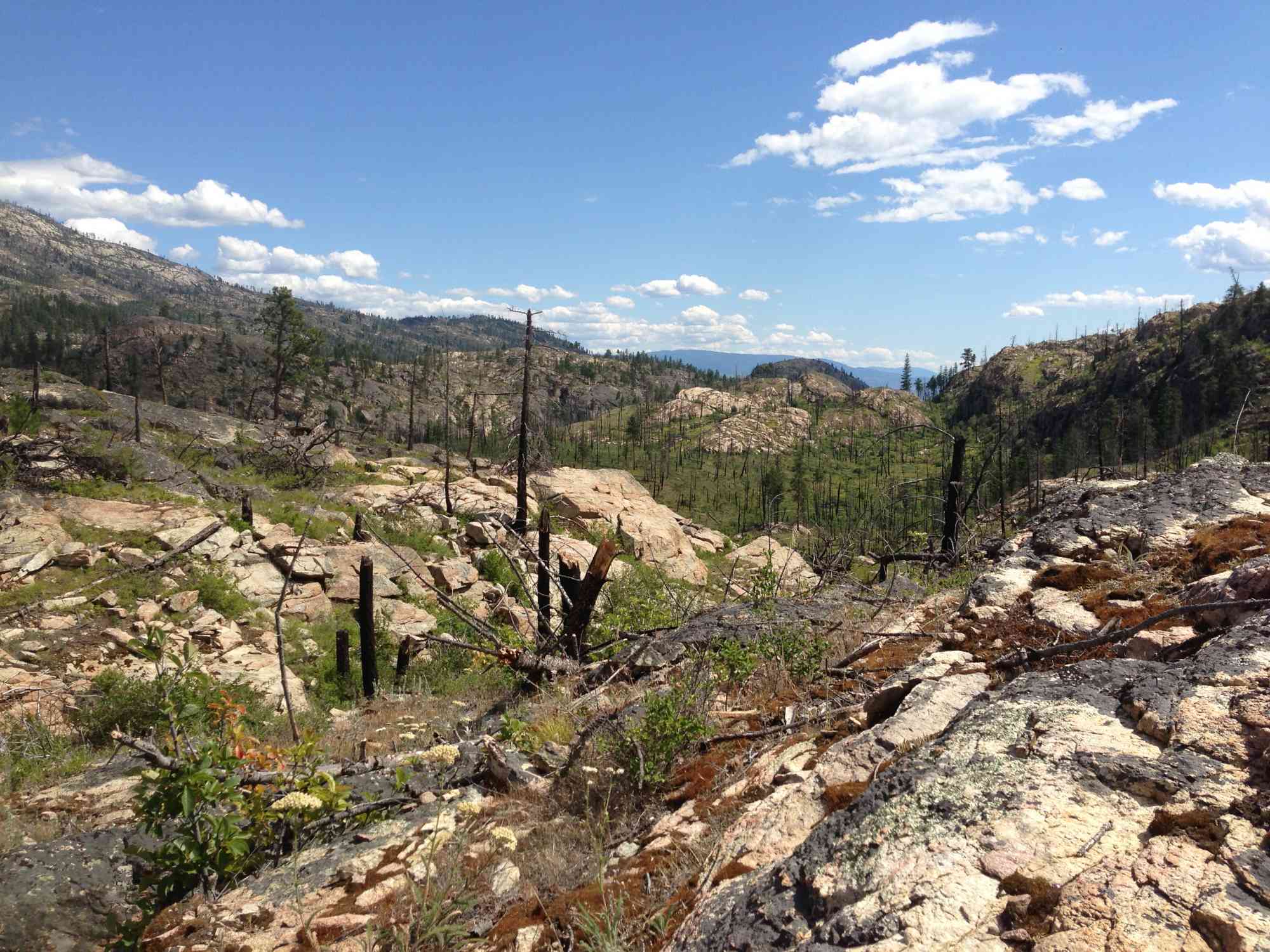
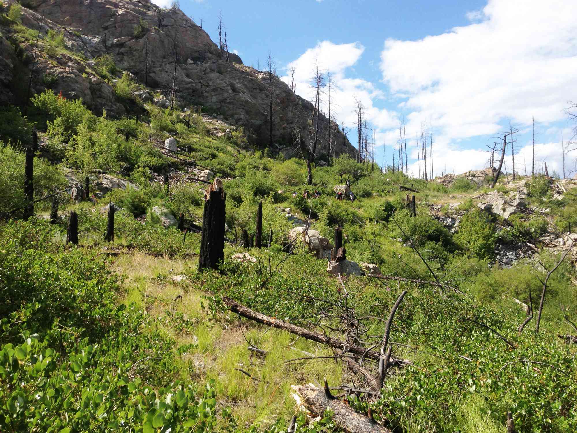
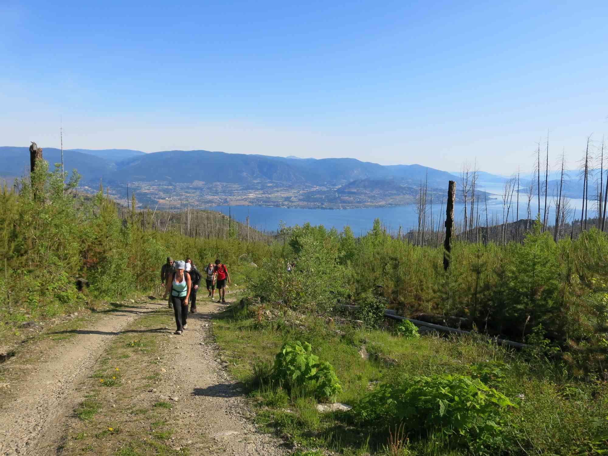
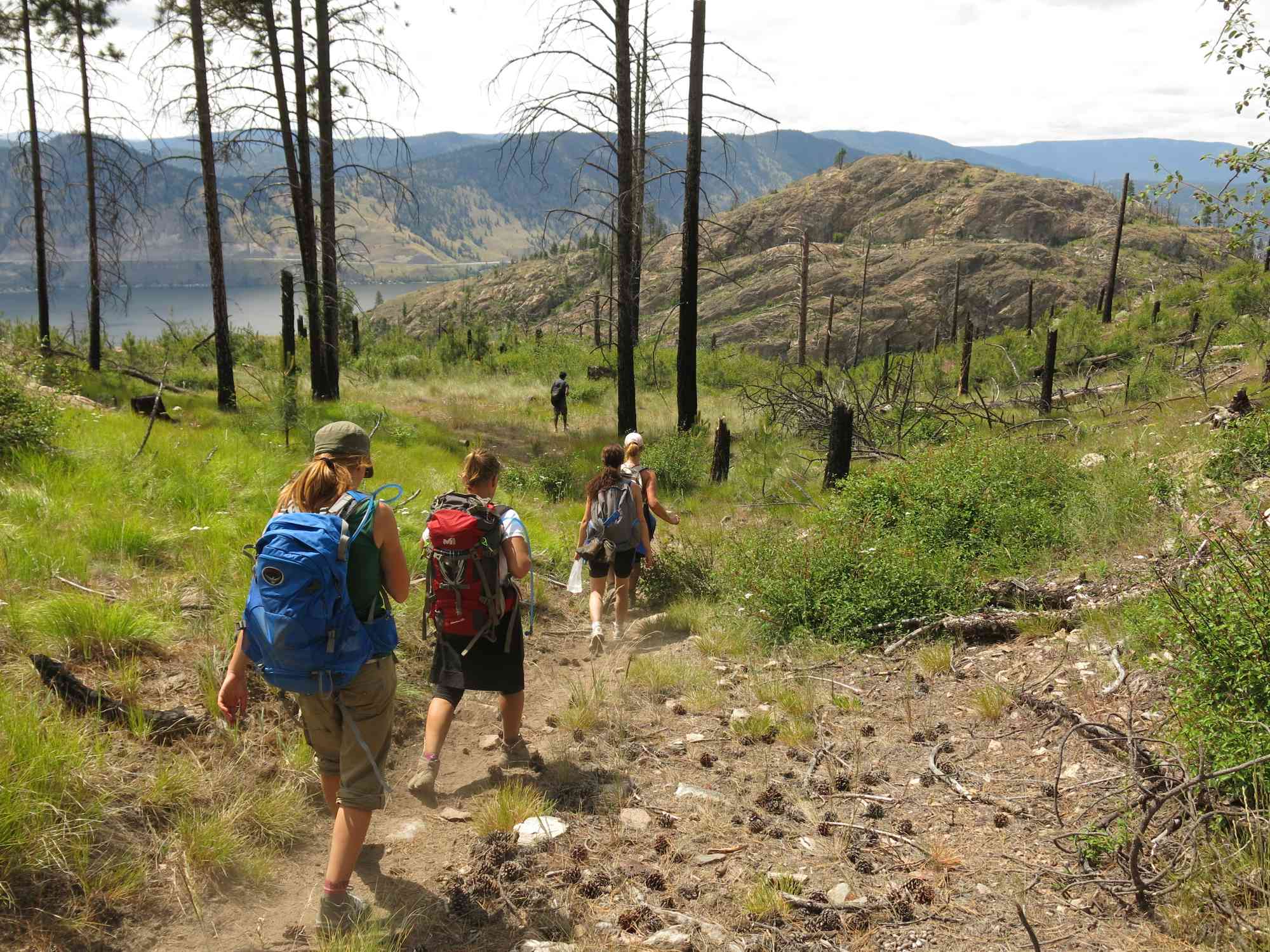
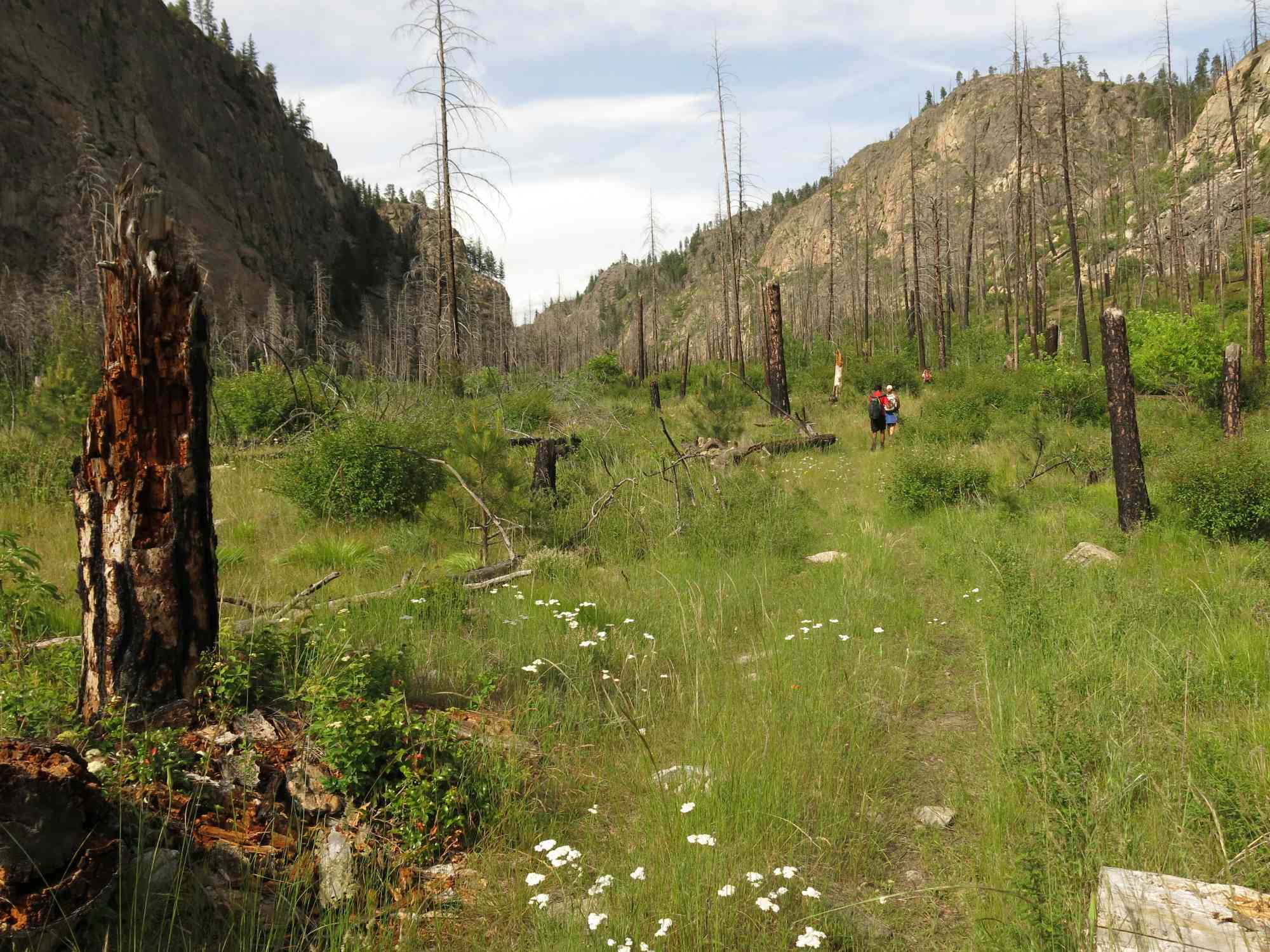
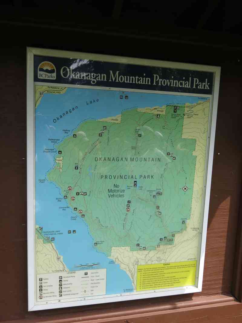
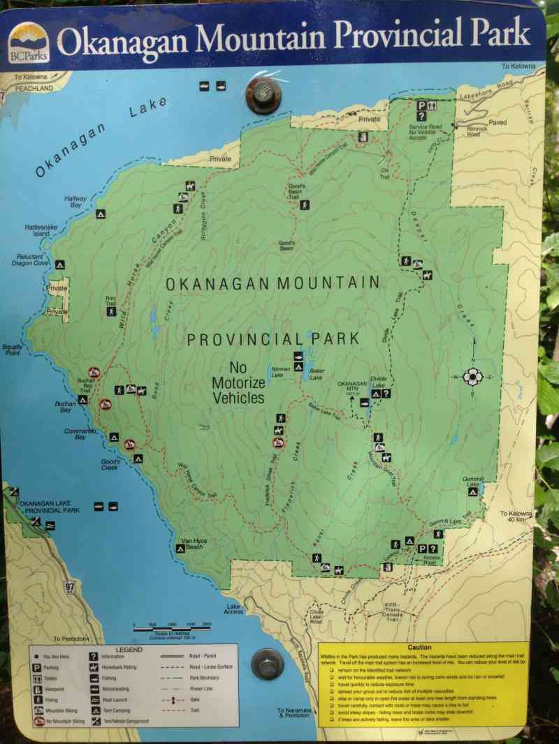
Originally established in 1973, Okanagan Mountain Park was subject to the 2003 Kelowna fires, and has been recovering rapidly since. From a huge diversity in wildlife (goats, deer, moose, elk, lynx, bears, coyote, western painted turtle, snakes) to edible plants, berries, and wildflowers, this incredibly scenic hike stretches over 46km and ascends 2.6 kilometers (8500 ft)! See a side of nature mostly free from the influence of man, but yet so close to home over this immense 11,000 hectare park.
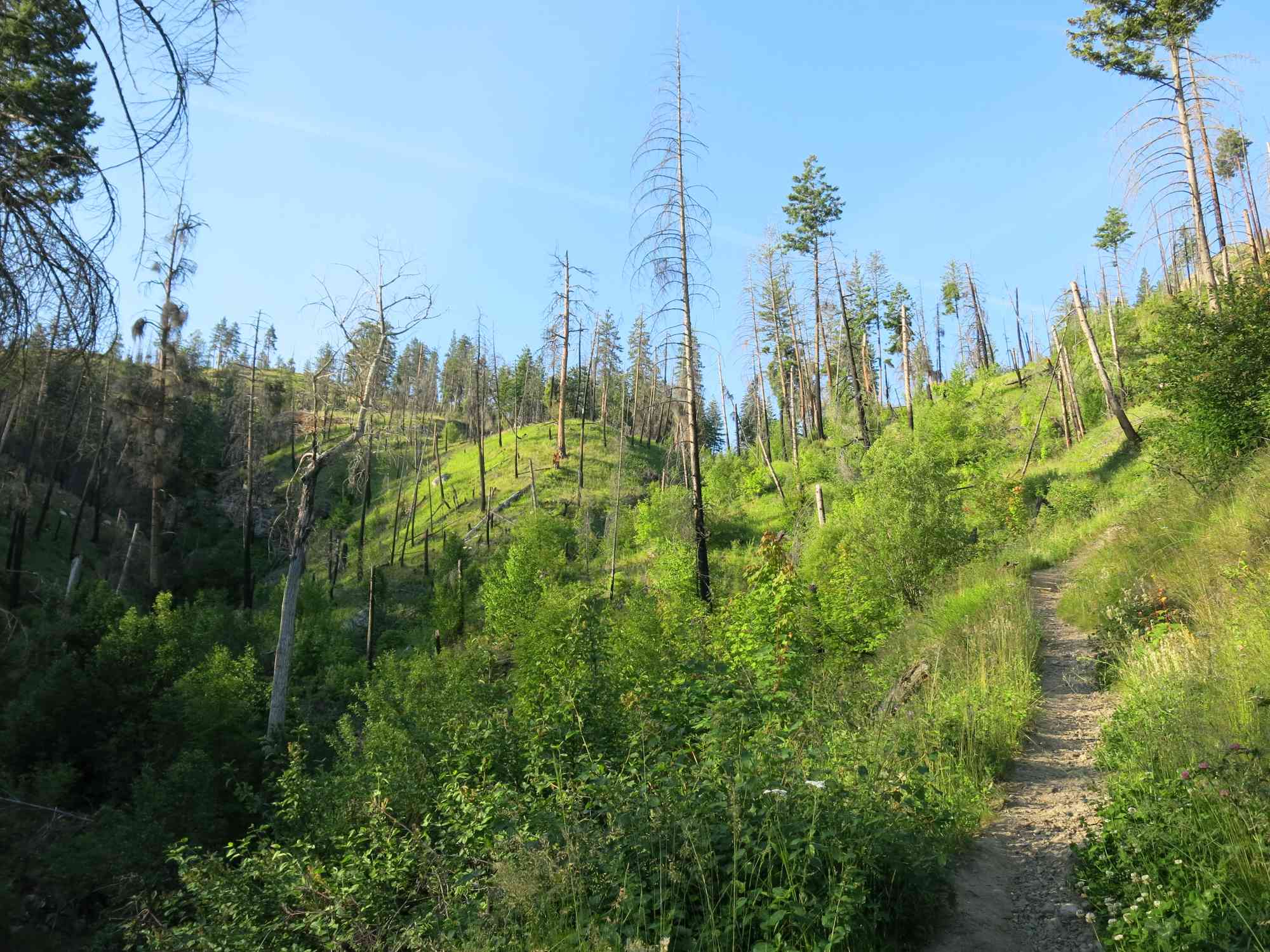
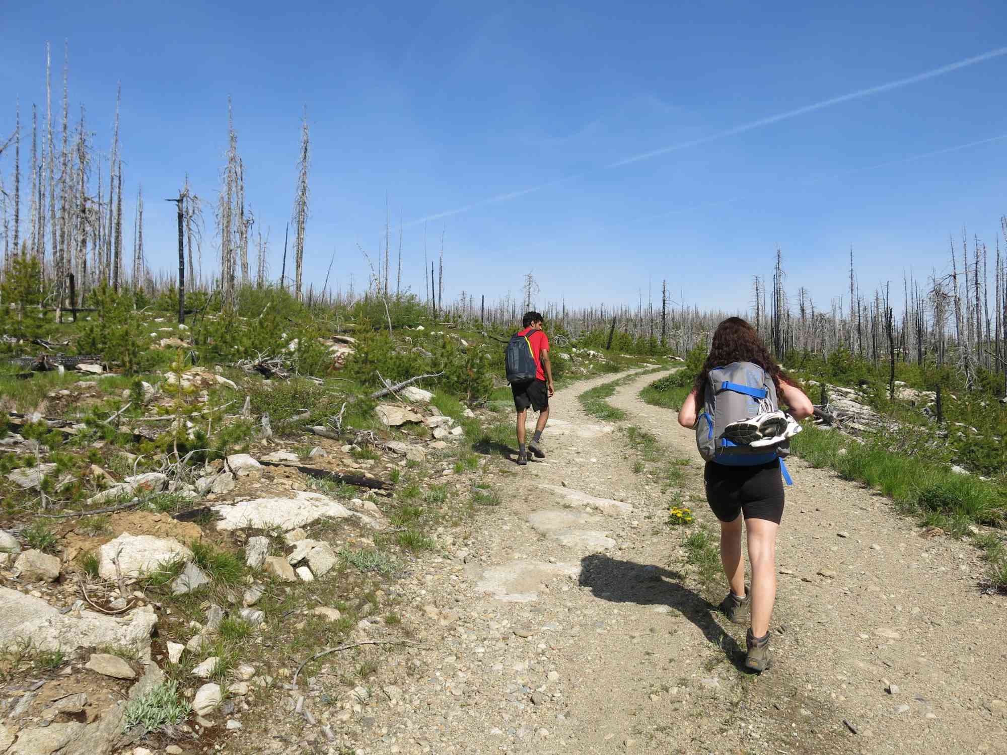
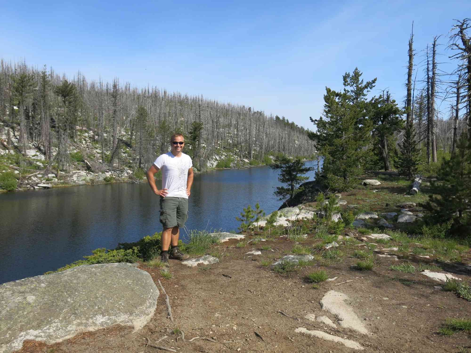
The park is full of historical evidence such as archaeological sites and First Nations pictographs on rocks and canyon walls. Its terrain varies and includes spruce and fir forests, grasslands, sagebrush, bitterroots and arid areas covered in ponderosa pine and cactus. Several parts of the area are barren and in a process of regrowth, watch out for fallen trees and other debris. The wildfire wiped out a vast amount of vegetation making certain areas of the Okanagan more visible, this also means that open spaces in the summer lead to a hot walk, bring plenty of water and sunscreen.
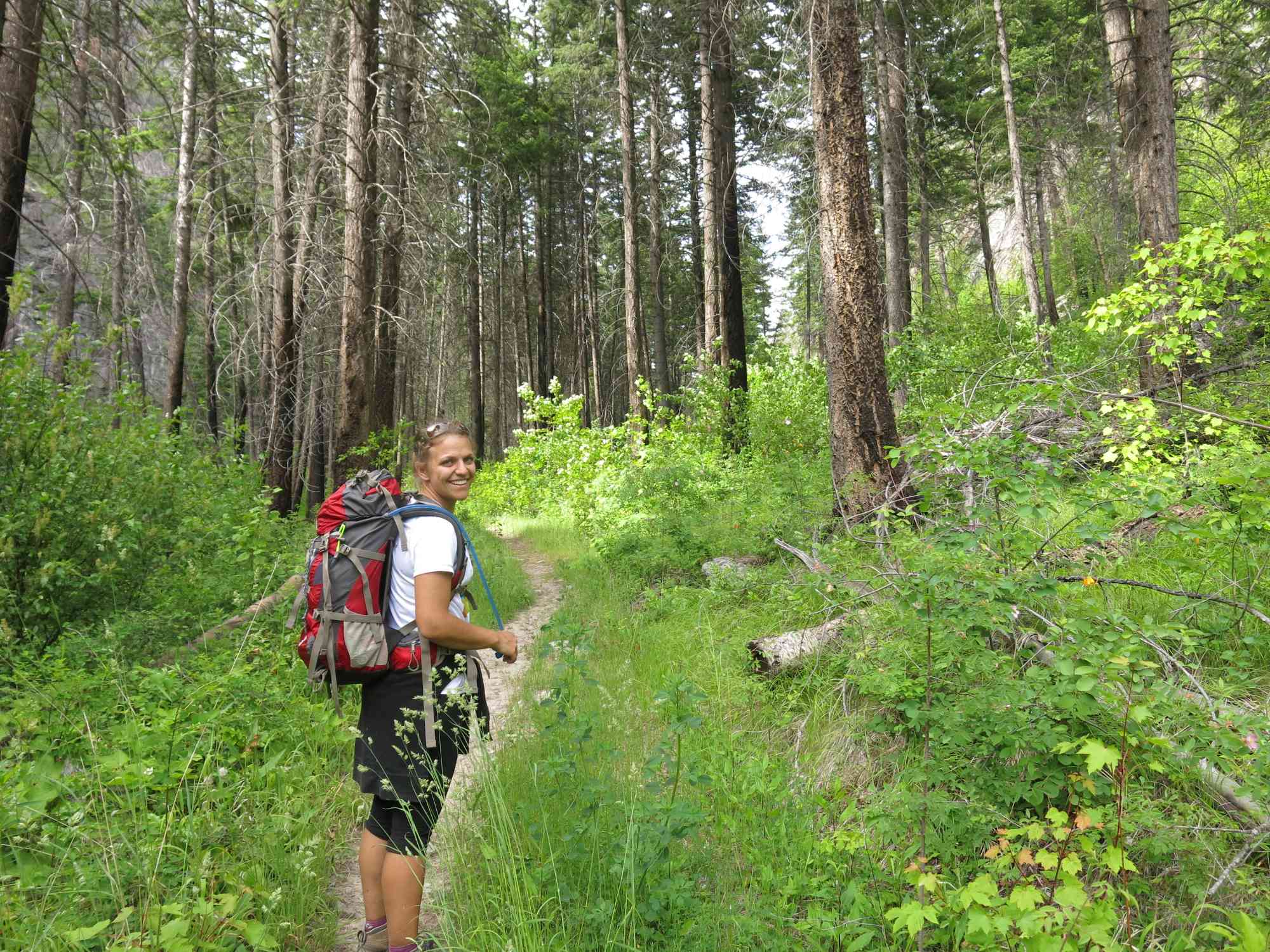
For the incredibly ambitious, set off at dawn, hike all day with minimal breaks through the scorching summer heat for anywhere between 11 (solo pace) and 15 hours (group pace). Push your body to its breaking point, and after the most intensive cardio workout of your life, be shaking and thrown into survival mode! For everyone else, this hike makes an moderately challenging but enjoyable 3 to 4 day hike.
Several sections of the hike have missing trail markers, follow path usage and landmarks closely or you may get lost. It is recommended to use a GPS device as the scenery in the park is actively changing.
---- Single Day Hike Suggested Supplies ----
• 2 liters fresh pre-filtered water. There are not many opportunities to refill. You wil likely drink upwards of 6 to 8 litres.
• Water pump, or friend who has one. You WILL run out of water.
• Lunch, dinner, trail snacks, and 1 extra emergency meal
• Emergency first aid/survival kit:
tensor bandage, bandaid, Imodium, antihistamine, Tylenol, ibuprofen, duct tape, lighter, disinfectant pads, sunscreen, pocket knife, scissors, gauze pads, tweezers, safety pins, compass, flashlight, emergency rain poncho, bear horn/spray, toilet paper
• Change of clothes (notably socks); maybe something slightly warmer?
• GPS capable cell phone w/extra battery pack. Ideally with digital map installed. (or a friend who has one).
• Printed copy of the park map & plan
• Signed waiver (will be distributed at start of hike)
---- Single Day Hike Checkpoints and Durations ----
CHECKPOINT 1: Divide Lake
6:30am to 9:30am 1200m gain/124m loss 11.5km 3hrs @ 3.8km/hr
Begin by ascending through a chilly valley until connecting with CN Trail, and then the very "open in the sun" Divide Lake Trail. This is THE MOST IMPORTANT part of the hike. Power-walk at a very solid pace. This section of trail alone will determine how late you get back, and how long breaks can be.
CHECKPOINT 2: Frederick Creek Fork
9:30am to 12:30pm 375m gain/1000m loss 11km 3 hours @ 3.6km/hr
Arrive at Divide Lake for 9:30am, and continue down Mountain Goat Trail, to the Emergency Exit location (break for 15 minutes). This section of trail is mostly downhill and goes very quickly. Then, to the fork at Frederick Creek where you can refill water if necessary. This section of trail is mostly flat, with some smaller uphill. Nothing compared to the trek up to Divide earlier in the day. Stop here for a 30 min lunch break.
CHECKPOINT 3: Good's Creek
1:00pm to 3pm 276m gain/707m loss 7.31km 2 hours @ 3.5km/hr
Hike mostly downhill from Frederick Creek to Good's Creek, but with one short but MAJOR valley crossing which can be challenging as you will be fatigued. There is a stream to fill up halfway through this leg of the trip.
CHECKPOINT 4: Commando Bay Trun-Off
3pm to 4:00pm 250m gain/250m loss 3.5km 1 hr @ 3.5km/h
Hike to the Buchan Bay/Commando Bay turn off, and take 15 minutes to rest in the shade under the big tree. The trail up to this point is out in the open and very hot. You'll likely have to push through overgrown trail at points and the continual ascent/descent can be draining.
CHECKPOINT 5: Kelowna Viewpoint (labelled as "View" on the map)
4:00pm to 5:40pm 250m gain/???m loss 6.5km 1hr, 40 min @ 4.0km/hr
Keeping right from Commando bay, hike to the "View" (boulders on right) for a short 20-min dinner over a nearly flat trail through the canyon with very little elevation gain.
CHECKPOINT 6: CN Trail Fork
6:00pm to 8:30pm 450m gain/400m loss 7km 2.5 hrs @ 3km/hr
We pass the Good's Basin turn-off halfway through, the "Flat Rock" waypoint (another great alternative for a dinner spot), and then connect to CN Trail. Alternatively, exit via the "Horse Creek" waypoint for an easier exit that is also slightly shorter.
CHECKPOINT 7: Home
8:30pm to 9:00pm 70m gain/230m loss 1.8km 30 min @ 3.5km/hr
Sun sets at 9:15pm mid-June. At this point, you have a good 40 minutes of usable light left to traverse the remainder and should be ahead of schedule.
---- Single Day Hike Escapes ----
Option 1: Backtrack!
16.56 km walking back to trailhead
1) 5.16 km from Emergency Exit to Divide Lake Campsite
2) 11.4 km from Emergency Exit to Vehicles
3) 30 min car ride into town
Option 2: Go to Naramata and taxi to car
13.12 km walking to town center
or 3.6 km walking w/Taxi from paved Chute Lake Trailend
Optionally, if you have a very good friend who also happens to have a truck, they can reach you here relatively easily. Drive from downtown Kelowna, then 4x4 down Chute Lake Rd (accessible from Kettle Valley); 35km from downtown Kelowna, 20km of which is on a dirt road. Anticipate 45 - 60 min driving time from downtown versus 1.5 hours driving the Peachland/Pentiction route.
1) 1.5 km from Emergency Exit to Chute Lake Rd
2) 4.7 km from Chute Lake Rd to Naramata Rd N
3) 6.92 km from Naramata Rd N to Town Centre (6.92 km) (or taxi)
4) 1.75 hour taxi drive back to vehicles ($200 minimum)
5) 30 min car ride into town
Option 3: Goode's Campsite w/Boat Pickup from a Friend
11.1 km walking + 17 km boat ride
1) 5.1 km to the Frederick Trail Fork
2) 6.0 km to Goode's Creek Campsite
3) ??? Time waiting for friend to rent/drive boat ($399)
4) 17 km Boat Ride to railhead
5) 30 min car ride into town
Originally established in 1973, Okanagan Mountain Park was subject to the 2003 Kelowna fires, and has been recovering rapidly since. From a huge diversity in wildlife (goats, deer, moose, elk, lynx, bears, coyote, western painted turtle, snakes) to edible plants, berries, and wildflowers, this incredibly scenic hike stretches over 46km and ascends 2.6 kilometers (8500 ft)! See a side of nature mostly free from the influence of man, but yet so close to home over this immense 11,000 hectare park.
The park is full of historical evidence such as archaeological sites and First Nations pictographs on rocks and canyon walls. Its terrain varies and includes spruce and fir forests, grasslands, sagebrush, bitterroots and arid areas covered in ponderosa pine and cactus. Several parts of the area are barren and in a process of regrowth, watch out for fallen trees and other debris. The wildfire wiped out a vast amount of vegetation making certain areas of the Okanagan more visible, this also means that open spaces in the summer lead to a hot walk, bring plenty of water and sunscreen.
For the incredibly ambitious, set off at dawn, hike all day with minimal breaks through the scorching summer heat for anywhere between 11 (solo pace) and 15 hours (group pace). Push your body to its breaking point, and after the most intensive cardio workout of your life, be shaking and thrown into survival mode! For everyone else, this hike makes an moderately challenging but enjoyable 3 to 4 day hike.
Several sections of the hike have missing trail markers, follow path usage and landmarks closely or you may get lost. It is recommended to use a GPS device as the scenery in the park is actively changing.
---- Single Day Hike Suggested Supplies ----
• 2 liters fresh pre-filtered water. There are not many opportunities to refill. You wil likely drink upwards of 6 to 8 litres.
• Water pump, or friend who has one. You WILL run out of water.
• Lunch, dinner, trail snacks, and 1 extra emergency meal
• Emergency first aid/survival kit:
tensor bandage, bandaid, Imodium, antihistamine, Tylenol, ibuprofen, duct tape, lighter, disinfectant pads, sunscreen, pocket knife, scissors, gauze pads, tweezers, safety pins, compass, flashlight, emergency rain poncho, bear horn/spray, toilet paper
• Change of clothes (notably socks); maybe something slightly warmer?
• GPS capable cell phone w/extra battery pack. Ideally with digital map installed. (or a friend who has one).
• Printed copy of the park map & plan
• Signed waiver (will be distributed at start of hike)
---- Single Day Hike Checkpoints and Durations ----
CHECKPOINT 1: Divide Lake
6:30am to 9:30am 1200m gain/124m loss 11.5km 3hrs @ 3.8km/hr
Begin by ascending through a chilly valley until connecting with CN Trail, and then the very "open in the sun" Divide Lake Trail. This is THE MOST IMPORTANT part of the hike. Power-walk at a very solid pace. This section of trail alone will determine how late you get back, and how long breaks can be.
CHECKPOINT 2: Frederick Creek Fork
9:30am to 12:30pm 375m gain/1000m loss 11km 3 hours @ 3.6km/hr
Arrive at Divide Lake for 9:30am, and continue down Mountain Goat Trail, to the Emergency Exit location (break for 15 minutes). This section of trail is mostly downhill and goes very quickly. Then, to the fork at Frederick Creek where you can refill water if necessary. This section of trail is mostly flat, with some smaller uphill. Nothing compared to the trek up to Divide earlier in the day. Stop here for a 30 min lunch break.
CHECKPOINT 3: Good's Creek
1:00pm to 3pm 276m gain/707m loss 7.31km 2 hours @ 3.5km/hr
Hike mostly downhill from Frederick Creek to Good's Creek, but with one short but MAJOR valley crossing which can be challenging as you will be fatigued. There is a stream to fill up halfway through this leg of the trip.
CHECKPOINT 4: Commando Bay Trun-Off
3pm to 4:00pm 250m gain/250m loss 3.5km 1 hr @ 3.5km/h
Hike to the Buchan Bay/Commando Bay turn off, and take 15 minutes to rest in the shade under the big tree. The trail up to this point is out in the open and very hot. You'll likely have to push through overgrown trail at points and the continual ascent/descent can be draining.
CHECKPOINT 5: Kelowna Viewpoint (labelled as "View" on the map)
4:00pm to 5:40pm 250m gain/???m loss 6.5km 1hr, 40 min @ 4.0km/hr
Keeping right from Commando bay, hike to the "View" (boulders on right) for a short 20-min dinner over a nearly flat trail through the canyon with very little elevation gain.
CHECKPOINT 6: CN Trail Fork
6:00pm to 8:30pm 450m gain/400m loss 7km 2.5 hrs @ 3km/hr
We pass the Good's Basin turn-off halfway through, the "Flat Rock" waypoint (another great alternative for a dinner spot), and then connect to CN Trail. Alternatively, exit via the "Horse Creek" waypoint for an easier exit that is also slightly shorter.
CHECKPOINT 7: Home
8:30pm to 9:00pm 70m gain/230m loss 1.8km 30 min @ 3.5km/hr
Sun sets at 9:15pm mid-June. At this point, you have a good 40 minutes of usable light left to traverse the remainder and should be ahead of schedule.
---- Single Day Hike Escapes ----
Option 1: Backtrack!
16.56 km walking back to trailhead
1) 5.16 km from Emergency Exit to Divide Lake Campsite
2) 11.4 km from Emergency Exit to Vehicles
3) 30 min car ride into town
Option 2: Go to Naramata and taxi to car
13.12 km walking to town center
or 3.6 km walking w/Taxi from paved Chute Lake Trailend
Optionally, if you have a very good friend who also happens to have a truck, they can reach you here relatively easily. Drive from downtown Kelowna, then 4x4 down Chute Lake Rd (accessible from Kettle Valley); 35km from downtown Kelowna, 20km of which is on a dirt road. Anticipate 45 - 60 min driving time from downtown versus 1.5 hours driving the Peachland/Pentiction route.
1) 1.5 km from Emergency Exit to Chute Lake Rd
2) 4.7 km from Chute Lake Rd to Naramata Rd N
3) 6.92 km from Naramata Rd N to Town Centre (6.92 km) (or taxi)
4) 1.75 hour taxi drive back to vehicles ($200 minimum)
5) 30 min car ride into town
Option 3: Goode's Campsite w/Boat Pickup from a Friend
11.1 km walking + 17 km boat ride
1) 5.1 km to the Frederick Trail Fork
2) 6.0 km to Goode's Creek Campsite
3) ??? Time waiting for friend to rent/drive boat ($399)
4) 17 km Boat Ride to railhead
5) 30 min car ride into town

Route
Kids & Pets
Features
Address
Driving Time
From Downtown Kelowna, approximate travel time by car is 30 min.
Notable GPS Co-ordinates
Detailed Directions
2. Follow Pandosy as it turns into Lakeshore Dr.
3. Stay on Lakeshore Dr. by turning RIGHT as you approach Kettle Valley.
4. After 8km, park at the Okanagan Mountain Park dirt parking lot on the right side of the road.
Google Directions
Duration Calculator
The metrics for this trail have been converted to round-trip formation for distance and elevation gain/descent if necessary.
Estimated Time:
-- hours
We have a downloadable GPS map for this trail!
Last Updated on Sunday, January 26, 2025
Need help using it? See our FAQ.GPS Notes
really hoping to do this one come June.. now to finish the test hike!!
Wednesday, May 28, 2014 at 8:47 AMThis is a stiff one-day endeavour. I have run this loop with three others, counterclockwise, in September (good time of year from a temperature and foliage standpoint), and have ridden through to Naramata in June (better water, but more foliage and hotter temperature to deal with).
Monday, May 30, 2016 at 12:22 PMBetter to hike this loop in reverse to ensure you have better access to water. Water quality can vary, but I have confidence refilling in any creek South of Wildhorse Canyon.
Leave a comment
You must Login to post a comment!